Ribeiro Bonito

A nice 10km walk where you will be guided by four caches

Grutas do Paúl

A great set of amazing caves carved into the stone.

Boca das Voltas

Boca das Voltas is a secret viewpoint offering a great scenary. It is ideal to those who enjoy a nice walk in the middle of the forest.

Cais de São Jorge

An historic pier that was once the gate to the north of the island. A beautiful panoramic view at the tip of the pier.

Garganta Funda

A huge 140m waterfall hidden from the common muggle. A test to your corage and a great view at the end.

Arte de Portas Abertas

A simple, old street that was transformed into an art galery. This multicache makes you look closely at each door. Discover its secrets!

O Pescador do Arieiro

This is a funny multi with only two stages that can be done in a short period of time. The cache is located near Pico Arieiro and offers stunning views.

The Cliffs

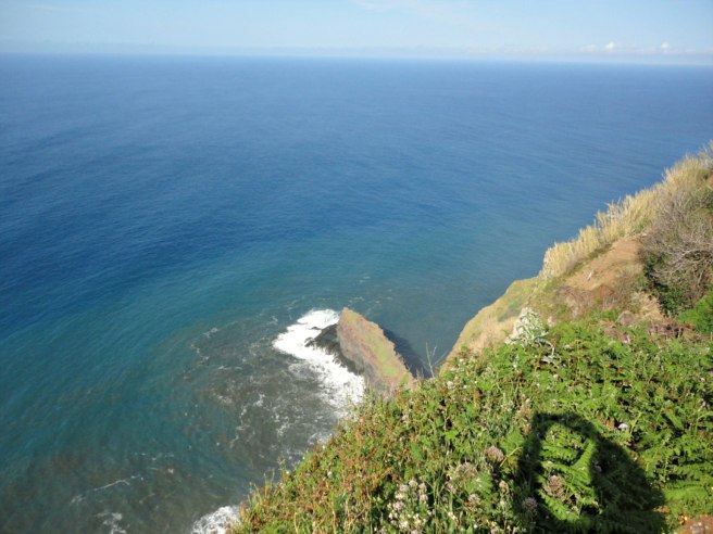
This multi cache will take you to walk along cliffs that reach from 250m to 500m altitude. The trail will present you with beautiful landscapes and interesting geological phenomena.

Mostrar mensagens com a etiqueta geocaching. Mostrar todas as mensagens

sexta-feira, 5 de julho de 2019

Churchill and the Monk Seal

Churchill and the Monk Seal
Câmara de Lobos


PT: 

Churchill e Câmara de Lobos

A visita de Churchill à Madeira, a convite do Reid's (Palace Hotel), foi uma campanha de 'marketing', porque os ingleses eram os principais clientes do hotel. A iniciativa teve um grande impacto e o hotel, no decurso dos anos 50 e 60, retorna aos tempos áureos, com a presença de muitos famosos 

O Reid's Palace Hotel endereçou o convite no verão de 1949, para assinalar a reabertura após a 2.ª Guerra Mundial, e Winston Churchill chegou à ilha no dia 1 de janeiro de 1950, a bordo do navio "Durban Castle". 

Dizem os relatos da visita que na viagem até ao hotel terá comentado: "Já fui cumprimentado por muitas pessoas neste mundo por quem fiz alguma coisa, mas nunca, em toda a minha vida, fui tão entusiasticamente recebido por pessoas por quem nunca fiz nada."

Uma vez instalado, permaneceu grande parte da estada no quarto, porque estava mau tempo. 

No dia 8 de janeiro de 1950 deslocou-se a Câmara de Lobos, sete quilómetros a oeste do Funchal, num automóvel Rolls Royce da família Leacock. Num recanto, à entrada da vila, montou o cavalete e a tela, sentou-se e pintou a baía e o ilhéu. O fotógrafo Raul Perestrelo imortalizou o momento e, atualmente, o local é designado por Miradouro Winston Churchill. 

Deixou a ilha a bordo de um hidroavião da companhia inglesa "Aquila Airways" no dia 12 de janeiro de 1950.

Winston Churchill morreu a 24 de janeiro de 1965, aos 95 anos. Foi primeiro-ministro britânico por duas vezes (1940-1945 e 1951-1955) e entrou para a história como um dos maiores estadistas do século XX. Em 1953, recebeu o Prémio Nobel da Literatura. 


O Lobo Marinho

A denominação do concelho de Câmara de Lobos está umbilicalmente ligada à espécie “Lobo Marinho”. Aquando da descoberta da Ilha da Madeira, em 1419, e na sequência do reconhecimento à costa, os marinheiros aportaram a uma baía onde encontraram uma grande colónia destes animais marinhos a que baptizaram de Câmara de Lobos.

Este animal, originário do Mar Mediterrâneo, está hoje em vias de extinção, sendo que na Região Autónoma da Madeira está confinado a uma pequena colónia nas ilhas Desertas.

A denominação cientifica desta espécie é “monachus monachus”, mas é vulgarmente conhecido por “Lobo Marinho” devido às vocalizações em tom de urro e também por ser um animal carnívoro. A denominação de “Foca Monge”, deve-se às pregas que possui no pescoço, quando está em descanso, que lembra um capucho de monge; e ainda por ser um animal de hábitos solitários. 

A Cache

Para logar esta cache virtual, você precisa realizar duas tarefas, visitando os dois pontos virtuais: 

1 - Tire uma foto em que apareça o seu nickname escrito (no telemóvel, num papel, numa t-shirt...) e a estátua de Churchill.
2 - Tire uma foto sua junto ao lobo marinho. Se não quiser se identificar, pode tirar a foto de costas. 

Recompensas Virtuais 2.0 - 2019/2020

Esta Cache Virtual faz parte de uma versão limitada, criada entre 4 de junho de 2019 e 4 de junho de 2020. Apenas 4.000 owners de caches tiveram a oportunidade de colocar uma Cache Virtual. Sabe mais sobre o Virtual Rewards 2.0 no Blog do Geocaching.


EN:

Churchill and Câmara de Lobos

Churchill's visit to Madeira at the invitation of Reid's (Palace Hotel) was a marketing campaign because the English were the hotel's main guests. The initiative had a great impact and the hotel, during the 50s and 60s, returned to its golden days, with the presence of many celebrities

Reid's Palace Hotel addressed the invitation in the summer of 1949 to mark the reopening after World War II, and Winston Churchill arrived on the island on January 1, 1950 aboard the ship "Durban Castle".

The reports of the visit tell us that on the trip to the hotel he commented: "I have been greeted by many people in the world for whom I have done something, but never in my life have I been so enthusiastically received by people for whom I have never done anything. "

Once installed, he stayed in the room for most of his stay, because of some bad weather.

On January 8, 1950 he went to Câmara de Lobos, seven kilometers west of Funchal, in a Rolls Royce car of the Leacock family. In a corner, at the entrance of the village, he mounted the easel and the canvas, sat down and painted the bay and the islet. The photographer Raul Perestrelo immortalized the moment and, currently, the place is designated by the Winston Churchill Viewpoint.

He left the island aboard a seaplane of the English company "Aquila Airways" on January 12, 1950.

Winston Churchill died on January 24, 1965, at age 95. He was British Prime Minister twice (1940-1945 and 1951-1955) and went down in history as one of the greatest statesmen of the twentieth century. In 1953, he received the Nobel Prize for Literature.

The Monk Seal

The denomination of the municipality of Câmara de Lobos is inextricably attached to the species "Lobo Marinho" - the Monk Seal. Upon the discovery of Madeira Island in 1419, and following the reconnaissance of the coast, the sailors landed on a bay where they found a large colony of these marine animals.

This animal, originating in the Mediterranean Sea, is now in extinction, and in Madeira it is confined to a small colony in the Desertas Islands.

The scientific name of this species is "monachus monachus", but it is commonly known as "Lobo Marinho" due to vocalizations in a howling tone and also because it is a carnivorous animal. The name Monk Seal, is due to the folds that it has in the neck, when it is at rest, that resembles a capuchin monk; and also for being an animal of solitary habits.

The cache

To log this virtual cache, you need to perform two tasks by visiting two virtual points:

1 - Take a picture that shows your written nickname (on the phone, on a paper, on a t-shirt ...) and the statue of Churchill.
2 - Take a picture of you next to the monk seal. If you do not want to identify yourself, you can take the photo facing the monk seal.

Virtual Rewards 2.0 - 2019/2020

This Virtual Cache is part of a limited release of Virtuals created between June 4, 2019 and June 4, 2020. Only 4,000 cache owners were given the opportunity to hide a Virtual Cache. Learn more about Virtual Rewards 2.0 on the Geocaching Blog.

quinta-feira, 3 de maio de 2018

Why do we have tunnels?


Why do we have tunnels?
Pedra Branca - ER101 - Ribeira Funda


PT:
Esta cache irá te convidar a conhecer parte da Estrada Regional 101. 
A Estrada Regional (ER) número 101 (ER101), com 205 km de extensão, merece especial destaque por ser uma obra de engenharia notável, realizada com os meios limitados da época, que só encontra paralelo na extraordinária rede de levadas construída ao longo dos séculos. Foi concluída a 6 de junho de 1958, com a inauguração do túnel Boa Ventura/Arco de São Jorge. Na passagem para o séc. XXI, encontra-se sem circulação rodoviária principal, mas está ainda na lembrança de muitos madeirenses e turistas o percurso vertiginoso da estrada escarpada na rocha da costa norte, desde São Vicente ao Porto Moniz. A sua imagem ficou gravada em muitos postais madeirenses.

Ao longo dos 3km (ida e volta) irás conhecer os problemas e ao mesmo a beleza desta outrora importante estrada. 
Este percurso deverá ser feito com boas condições metereológicas. Evita os dias de chuva e vento.
No início o percurso é acessível, tendo apenas uma área mais sensível após o túnel de acesso à Ribeira Funda.


Boa sorte!


EN:
This cache will invite you to visit the Regional Road 101.

The Regional Road (ER) number 101 (ER101), with 205 km of extension, deserves special mention because it is a remarkable engineering work carried out with the limited means of the time, that only finds parallel in the extraordinary network of "levadas" constructed along the centuries. It was completed on June 6, 1958, with the inauguration of the Boa Ventura / Arco de São Jorge tunnel. In the early XXI century, it longer has main road traffic, but it is still in the memory of many Madeirans and tourists the dizzying route of the steep road on the rock of the north coast, from São Vicente to Porto Moniz. Its image was engraved on many Madeiran postcards.

Along the 3km (round trip) you will discover the problems and at the same time the beauty of this once important road.
This course should be done with good weather conditions. Avoid the rainy and windy days.
At the beginning the route is accessible, having only a more sensitive area after the access tunnel to Ribeira Funda.

Good Luck!


Flag Counter

segunda-feira, 5 de março de 2018

Galinhaça


GALINHAÇA
Vereda da Cavaca - Cabeço das Moitadinhas - Ribeira da Galinhaça


PT: 
Esta cache irá te convidar a conhecer a Vereda da Cavaca.
A cache está colocada no cruzamento entre a Vereda Cavaca e a Ribeira da Galinhaça a cerca de 750m de altitude.
Durante a época de chuvas poderás observar uma das cascatas desta ribeira. No verão terá um caudal muito reduzido.
Poderás iniciar o percurso no Chão da Ribeira (360m de altitude) ou no Fio - Fanal (1150m).
Poderás também efectuar um percurso circular e encontrar mais algumas caches utilizando o Caminho das Voltas.


EN: 

This cache will invite you to visit the Vereda da Cavaca.

The cache is placed at the intersection between Vereda Cavaca and Ribeira da Galinhaça at about 750m altitude.

During the rainy season you can observe one of the waterfalls of this water stream. In summer it will have a very reduced flow.
You can start the course at Chão da Ribeira (360m altitude) or at Fio - Fanal (1150m).
You can also make a circular route and find some more caches using the Caminho das Voltas.


Flag Counter

quinta-feira, 7 de dezembro de 2017

Madeira na Geocaching Magazin


O geocacher alemão vanWeyden esteve recentemente na Madeira onde aproveitou para fazer geocaching e para escrever um artigo para a Geocaching Magazin. Tive a oportunidade de contribuir com uma pequena entrevista.
O artigo fez sucesso e deu origem a um segundo artigo sobre a ilha.

Curiosamente já alguns turistas fizeram referência a estes artigos nos seus logs:

Kingdom of the Ents (GC3H7AA) has a new log:  
Logged by: OmaSus  Log Type: Found it  Date: 11/12/2017  Location: Arquipélago da Madeira, Portugal  Type: Multi-cache
Log:
Am Start fanden wir nur das, was auch in einem Log von 3.11. beschrieben steht. Schade, also zurück zum CM. Aber dann hatten wir wirkliches Glück: An unserem letzten Cache in dieser Ecke trafen wir andere Cacher, und bei einem Plausch über unser wunderbares Hobby kamen wir auf diesen Cache zu sprechen. Die beiden waren so nett, uns die Koordinaten von St. 2 zu geben, und schon zog es mich zurück zum Kingdom of the Ens. So konnten wir diesen Multi, auf dem ich im Geocaching-Magazin aufmerksam geworden bin, doch noch zuende bringen.

Rain (GC3W0FB) has a new log: 
Logged by: Neon Knight  Log Type: Found it   Date: 07/07/2017   Location: Arquipélago da Madeira, Portugal  Type: Traditional Cache
Log:
After we had finished the Multi Levadas da Lombada we drove to the west - heading to visit the lighthouse of Ponta do Pargo. On our way we came along this cache, where we had lots of fun and really enjoyed it. This cache is mentioned in the German "Geocaching-Magazin" as one of the "must-do-caches" on Madeira ... and indeed ... it is a "must-do-cache" [:D] Tftc Hilli & NK FAV


Artigo 1:


Artigo 2:

quarta-feira, 24 de maio de 2017

Ribeira do Jardim


RIBEIRA DO JARDIM


PT: 
Esta cache irá te convidar a conhecer parte do curso de água da Ribeira do Jardim junto à Levada do Norte.
A dificuldade do acesso irá depender do caudal da ribeira. 
Junto à cache poderás ver a Cascata da Aguagem (48m). 
Durante os meses da primavera poderás também ter a oportunidade de apreciar as cerejeiras em flor.
Existem várias formas de chegar até este local. Na listing são dadas três coordenadas com diferentes sítios onde começar este percurso.


EN: 
This cache will invite you to get to know part of the water course of Ribeira do Jardim next to Levada do Norte.
The difficulty of access will depend on the flow of the stream.
Next to the cache you will see the Aguagem Waterfall (48m).
During the spring months you will also have the opportunity to enjoy the cherry blossoms.
There are several ways to get to this location. In the listing three coordinates are given with different places where to begin this route.

Flag Counter

Twin Waterfalls


TWIN WATERFALLS


PT:
Esta cache irá te conduzir a duas bonitas cascatas situadas junto à madre da Levada Nova de Santa Cruz.

Existem várias formas de chegar até este local. Na listing são dadas três coordenadas com diferentes sítios onde começar este percurso:

I - Levada Nova de Santa Cruz
Total: 4,8km / 2h

II - Levada dos Tornos - Vereda do Alvoredo - Levada Nova
Total: 3km / 1h

III - Percurso Circular:
Levada Nova do Moinho da Serra - Ponte de Roma - Levada dos Tornos - Vereda do Alvoredo - Levada Nova de Santa Cruz - Madre da Levada Nova de Santa Cruz - Levada Nova de Santa Cruz
Total: 13km / 4h

Ao chegar à madre da Levada Nova de Santa Cruz atravesse o curso de àgua e siga em frente de pedra em pedra. Poucos metros depois irá ver na Ribeira de Santa Cruz a sua cascata de dois ressaltos, ladeada de colunas prismáticas. Linda e única.
Ali mesmo ao lado a Ribeira Primeira une-se à Ribeira de Santa Cruz e podemos ver também outra cascata. Subindo um pouco até a base dessa cascata podemos ver um afluente com outa cascata.


EN:
This cache will lead you to two beautiful waterfalls located next to the source of Levada Nova de Santa Cruz. 

There are several ways to get to this location. In the listing three coordinates are given with different places where to start this route:

I - Levada Nova de Santa Cruz
Total: 4,8km / 2h

II - Levada dos Tornos - Vereda do Alvoredo - Levada Nova
Total: 3km / 1h

III - Round-Trip:
Levada Nova do Moinho da Serra - Ponte de Roma - Levada dos Tornos - Vereda do Alvoredo - Levada Nova de Santa Cruz - Madre da Levada Nova de Santa Cruz - Levada Nova de Santa Cruz
Total: 13km / 4h

When reaching the source of the levada, improvise, cross the water course and go ahead from stone to stone. A few meters later you will see Ribeira de Santa Cruz and its waterfall with two junps flanked with prismatic columns. Beautiful and unique.
Right beside the aforementioned waterfall, Ribeira Primeira joins with Ribeira de Santa Cruz and we can see another waterfall. Climbing a little to the base of this waterfall we can see a tributary with a smaller waterfall.


Flag Counter

domingo, 12 de março de 2017

Aguage


AGUAGE


PT:
Esta cache irá vos conduzir até uma cascata localizada entre sítios dos Lamaceiros e Feiteira do Nuno em Santana, localmente designada por Aguage, Águaje ou Agua D'Alto.
Aguage provirá do vocábulo aguagem: corrente impetuosa de água.
Naturalmente que a sua impetuosidade irá variar de acordo com as estações do ano.
O acesso a esta cascata faz-se por uma pequena estrada de gravilha/cimento.
Há perto da cascata um espaço para virar o carro e estacionar.


EN:
This cache will lead you to a waterfall located between sites of Lamaceiros and Feiteira do Nuno in Santana, locally designated by Aguage, Águaje or Agua D'Alto.
Aguage probably owes its origin the portuguese word aguagem: impetuous current of water.
Naturally its impetuosity will vary according to the seasons.
The access to this waterfall is via a small gravel/cement road.
Near the waterfall there is a space to turn the car and park.

Flag Counter

sábado, 25 de fevereiro de 2017

Os Arredados - Cascata do Rabo do Burro ou da Fajã Escura


OS ARREDADOS
Cascata do Rabo do Burro ou da Fajã Escura


PT:
A Missa do Parto dos Arredados é já uma tradição anual na Freguesia De Ponta Delgada, realizando-se habitualmente no último domingo antes do Natal.
É uma missa que reúne sempre muitas pessoas de várias zonas da Madeira, sendo por intenção das pessoas que raramente participam nas cerimónias religiosas e como tal estão arredadas da liturgia.

Tal como os arredados estão afastados das liturgias também algumas pessoas estão arredadas da Natureza. Esta cache é um convite para um regresso à Natureza, uma purificação e quem sabe com um lavar dos pés incluído.

ATENÇÃO:
- A dificuldade desta cache depende do caudal da ribeira. Analisa as condições e não arrisques.
- Existe um trilho pouco marcado na margem oeste (ver spoiler). Utilizando o trilho serão poucas as vezes que terás de andar dentro da ribeira.
- O percurso deverá ser feito apenas com boas condições climatéricas.
- Deverás levar água e comida, roupa e calçado apropriados (roupa extra para o caso de te molhares).
- A utilização de um bordão é recomendada.
- O sinal GPS é muito fraco por isso utiliza a Hint e o Spoiler.
- Carro - Cache - Carro: 1 km, 40m


EN:
The Arredados Mass in honour of the birth of Jesus is already an annual tradition in the Parish of Ponta Delgada, usually taking place on the last Sunday before Christmas.
It is a mass that always gathers many people from various parts of Madeira and is intended to the Arredados (people who rarely participate in religious ceremonies and as such are distant from the liturgy).

As the Arredados are distant from the liturgies also some people are cut off from Nature.
This cache is an invitation for a return to nature, a purification and who knows with a Washing of the Feet included.

"In every walk with Nature one receives far more than he seeks." John Muir

ATTENTION:
- The difficulty of this cache depends on the flow of the stream. Analyze the conditions and don't take risks.
- There is a trail on the west bank (see spoiler). If you use the trail you will avoid walking inside the river bed most of the way.
- The course must be done only with good weather conditions.
- You should bring water and food, clothing and appropriate footwear (extra clothing in case you get too wet).
- The use of walking poles is recommended.
-The GPS signal is very weak in this area so use the Hint and the Spoiler.
- Car - Cache - Car: 1 km, 40m


Flag Counter

sexta-feira, 13 de janeiro de 2017

Geocache of the Week - Senhora da Pedra


GOTW Senhora da Pedra, Madeira Portugal


Senhor da Pedra—Geocache of the Week


Traditional
 
GC2ZWP5
 
by luisftas
 
Difficulty:
 
4
 
Terrain:
 
3.5
Location:
 
Arquipélago da Madeira, Portugal
 
N 32° 50.110 W 016° 54.419


GOTW Senhora da Pedra, Madeira Portugal

Off the southwest coast of Portugal and northwest coast of Africa lies the beautiful archipelago of Madeira. It is the outermost region of the European Union and an autonomous region of Portugal. Known for its idyllic climate, flowing wine, romantic beaches, and sheer cliffs, Madeira is also home to close to 1,200 active geocaches.
You must be thinking, “Geocaching in gloriously warm climate with stunning landscapes and flowing wine—where’s the grit and the character-building adventure of that?!” Luckily, this traditional cache provides a mildly challenging hike with a big pay off in a phenomenal location. Perfect!
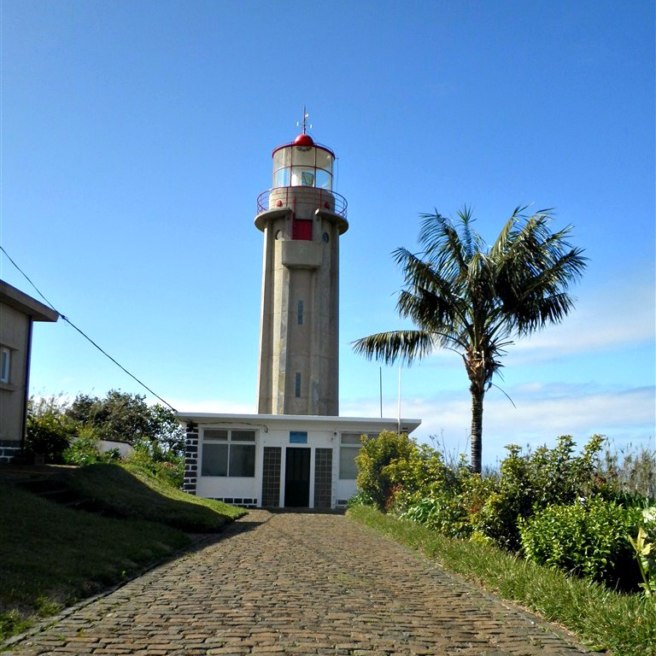
You’ll start your journey at the São Jorge (St. George) lighthouse, a sweet little spot to prepare for your trek and take in the ocean views. The lighthouse was, “…designed in 1948 and started to function in 1959. Its structure is a cylindrical tower 14-meters high, and the focus is at an altitude of 271 meters. Its light has a range of 16 miles, and its operation is automated in 1986 after being electrified in 1962.”


São Jorge (St. George) lighthouse

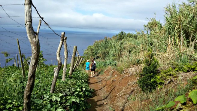
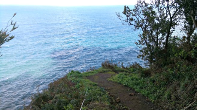
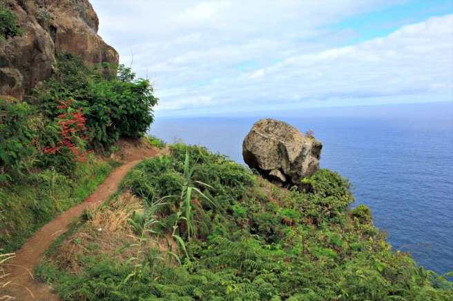
The next step is to find the path to the geocache. Once you are on the path, you will see why this geocache earned its 3.5 terrain rating. There are many paths—will you take the correct one? Will your path be full of mud with no alternate route? Will you slip and fall in the mud? Will this actually be worth it? Stay strong, intrepid geocachers, because yes, the payoff will be worth it.


Path to the geocache

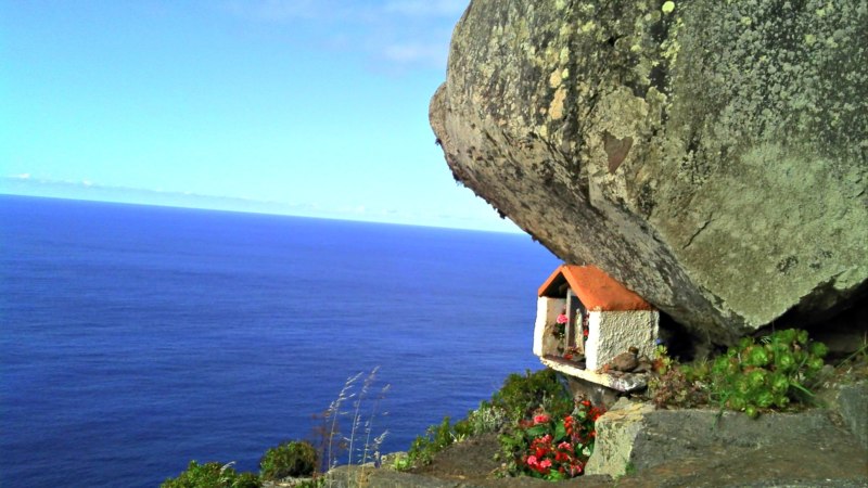
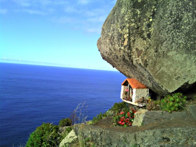
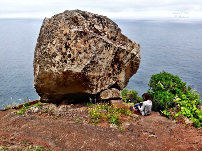
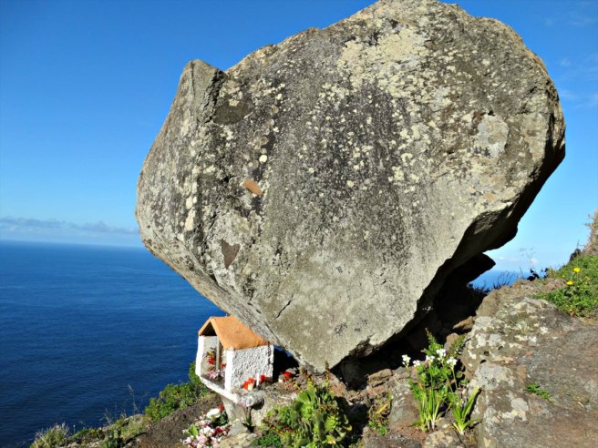
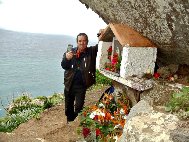
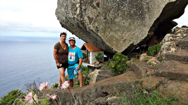
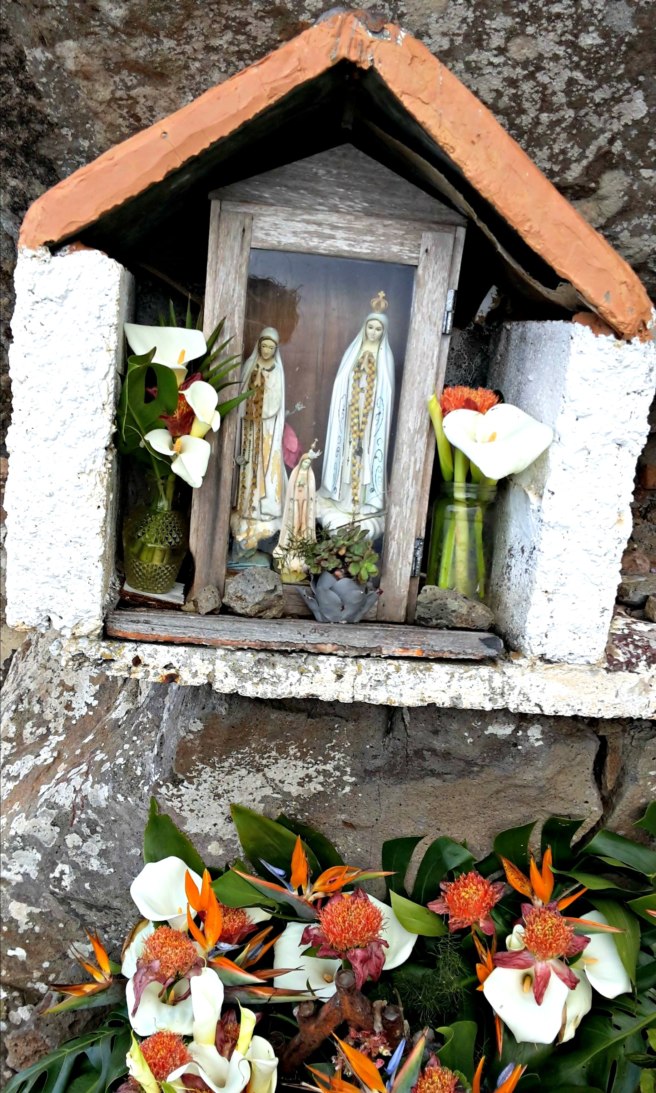
At the end of the path on the very edge of a cliff, you will find a very large rock. Many years ago it broke free from the hills above, rolled down the rugged terrain, then suddenly stopped right on this precipice. This was so amazing and odd that the locals built a small shrine in honor of the “Lady of the Stone” and placed it underneath the boulder. This “monument’ is full of religious statues, candles, flowers, stones, and other knickknacks. It is also a wonderful place for quiet reflection and to sign a logbook.


Path to the geocache

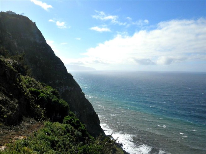
If this amazing rock and little shrine weren’t enough, check out that view! On the left you can see Porto Moniz very far away, while on the right you can look down and see the old pier of São Jorge. Can it get any better than this?


View from above the rock

Recent logs:
Siggi72This is my second time visiting Madeira but the first time with Geocaching. Without geocaching I wouldn’t have seen this “balancing” rock with the small shrine and the great views. Thanks for showing!


Amazing location for a geocache

ComètesOn our way, we could not miss this cache, that we already bookmarked in France when preparing our trip. Its D/T ratio is the only one missing in on matrix. We first discovered the lighthouse, then went down to GZ. 148 steps later, we were at the right place. A special place, as many ones that we can discover since we are practising geocaching. We found the box with the help of the spoiler. While we were signing the logbook, a rainbow appeared above the Ocean. To celebrate our fully filled matrix? Thank you for this great cache!


At the shrine under the rock

ED77First we had problems to find the right access and had almost given up. Fortunately we found the right way otherwise we have missed a great adventure and a total crazy place! The path down was a real adventure but at the end worth every step How curious to place a shrine under this huge stone! We enjoyed the mystic and peaceful place, stayed some time staring at the sea This place is worth a favorite point


Just before the geocache
Great view and a great experience
The shrine
The shrine
Gorgeous views
Gorgeous views
View to the right
View to the right
Even pooches love this geocache


Source: https://www.geocaching.com/blog/2016/12/senhor-da-pedra-geocache-of-the-week/ (01/2017)

quinta-feira, 15 de dezembro de 2016

GeoFoto

Com a rubrica "GeoFoto", o sítio GeoPT  pretende lançar um passatempo interno entre os utilizadores do forum, que permita divulgar as suas fotos, bem como caches ou histórias por detrás desses momentos.

Aqui ficam as minhas participações com mais destaque:

Tema: 
Macro: Visto de Perto!

Tema: 
Quatro Elementos


Tema: 
Portas / Janelas


sexta-feira, 29 de abril de 2016

Salto do Patagarro


SALTO DO PATAGARRO / RIBEIRA DE SANTA LUZIA


CACHE: 
  • O Patagarro é uma das 8 espécies de aves marinhas que nidifica no arquipélago da Madeira.
    Conhece mais pesquisando o Projecto Puffinus.
  • A cache está situada na Ribeira de Santa Luzia. 
  • Não existe trilho. Deverás improvisar, tendo de atravessar várias vezes a ribeira.
  • Para lá chegar existem outras alternativas mas esta será a mais simples 
  • Há a possibilidade de conjugar com outras caches da área: GC4FVVW, GC17K6C, GC17K5H e GC3T7QN.
  • O local possui fraco sinal GPS pelo que deverão utilizar os spoilers e dicas fornecidas. 
  • A dificuldade desta cache depende do caudal da ribeira. Durante os meses de verão o acesso poderá ser mais simples mas a cascata poderá estar seca. Analisa as condições e não arrisques.
  • O percurso deverá ser feito apenas com boas condições climatéricas.
  • Deverás levar água e comida, roupa e calçado apropriados (roupa e calçado extra para o caso de te molhares).
  • A utilização de um bordão é recomendada.
  • Parking - Cache - Parking: 9 km, 4h


CACHE: 
  • The Patagarro is one of the 8 species of seabird that nests in the Madeira archipelago. Know more by searching for the Project Puffinus.
  • The cache is located in Ribeira de Santa Luzia.
  • There is no trail. You have to improvise, having to cross the river several times.
  • To get there, there are other alternatives but this is probably the easiest. 
  • It is possible to combine with other caches in the area: GC4FVVW, GC17K6C, GC17K5H and GC3T7QN.
  • The location has weak GPS signal and you should therefore use the spoilers and hints provided.
  • The difficulty of this cache depends on the flow of the stream. During the summer months access may be simpler but the waterfall may be dry. Analyze the conditions and don't take risks.
  • The course must be done only with good weather conditions.
  • You should bring water, food, clothing and appropriate footwear (extra clothing in case you get wet). 
  • The use of walking poles is recommended.
  • Parking - Cache - Parking: 9 km, 4h

Flag Counter

Related Posts Plugin for WordPress, Blogger...

The best places to stay in Madeira

Feel like a local, find great places to stay and win a bonus for your first visit!

Geocaching Video