This is a funny multi with only two stages that can be done in a short period of time.
The cache is located near Pico Arieiro and offers stunning views.
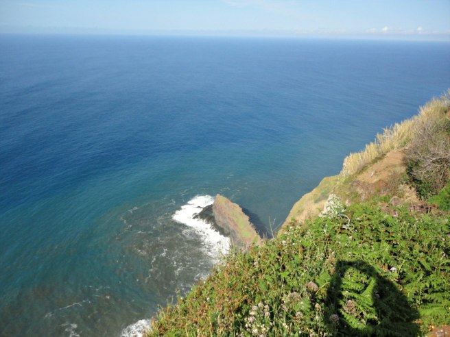
This multi cache will take you to walk along cliffs that reach from 250m to 500m altitude. The trail will present you with beautiful landscapes and interesting geological phenomena.
OS ARREDADOS Cascata do Rabo do Burro ou da Fajã Escura
PT:
A Missa do Parto dos Arredados é já uma tradição anual na Freguesia De Ponta Delgada, realizando-se habitualmente no último domingo antes do Natal.
É uma missa que reúne sempre muitas pessoas de várias zonas da Madeira, sendo por intenção das pessoas que raramente participam nas cerimónias religiosas e como tal estão arredadas da liturgia.
Tal como os arredados estão afastados das liturgias também algumas pessoas estão arredadas da Natureza. Esta cache é um convite para um regresso à Natureza, uma purificação e quem sabe com um lavar dos pés incluído.
ATENÇÃO:
- A dificuldade desta cache depende do caudal da ribeira. Analisa as condições e não arrisques.
- Existe um trilho pouco marcado na margem oeste (ver spoiler). Utilizando o trilho serão poucas as vezes que terás de andar dentro da ribeira.
- O percurso deverá ser feito apenas com boas condições climatéricas.
- Deverás levar água e comida, roupa e calçado apropriados (roupa extra para o caso de te molhares).
- A utilização de um bordão é recomendada.
- O sinal GPS é muito fraco por isso utiliza a Hint e o Spoiler.
- Carro - Cache - Carro: 1 km, 40m
EN:
The Arredados Mass in honour of the birth of Jesus is already an annual tradition in the Parish of Ponta Delgada, usually taking place on the last Sunday before Christmas.
It is a mass that always gathers many people from various parts of Madeira and is intended to the Arredados (people who rarely participate in religious ceremonies and as such are distant from the liturgy).
As the Arredados are distant from the liturgies also some people are cut off from Nature.
This cache is an invitation for a return to nature, a purification and who knows with a Washing of the Feet included.
"In every walk with Nature one receives far more than he seeks." John Muir
ATTENTION:
- The difficulty of this cache depends on the flow of the stream. Analyze the conditions and don't take risks.
- There is a trail on the west bank (see spoiler). If you use the trail you will avoid walking inside the river bed most of the way.
- The course must be done only with good weather conditions.
- You should bring water and food, clothing and appropriate footwear (extra clothing in case you get too wet).
- The use of walking poles is recommended.
-The GPS signal is very weak in this area so use the Hint and the Spoiler.
- Car - Cache - Car: 1 km, 40m
Off the southwest coast of Portugal and northwest coast of Africa lies the beautiful archipelago of Madeira. It is the outermost region of the European Union and an autonomous region of Portugal. Known for its idyllic climate, flowing wine, romantic beaches, and sheer cliffs, Madeira is also home to close to 1,200 active geocaches.
You must be thinking, “Geocaching in gloriously warm climate with stunning landscapes and flowing wine—where’s the grit and the character-building adventure of that?!” Luckily, this traditional cache provides a mildly challenging hike with a big pay off in a phenomenal location. Perfect!
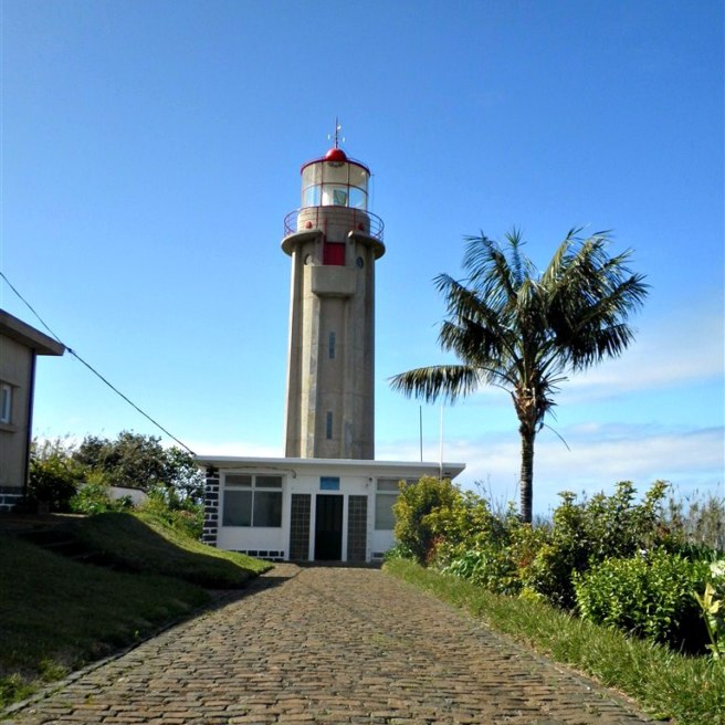
You’ll start your journey at the São Jorge (St. George) lighthouse, a sweet little spot to prepare for your trek and take in the ocean views. The lighthouse was, “…designed in 1948 and started to function in 1959. Its structure is a cylindrical tower 14-meters high, and the focus is at an altitude of 271 meters. Its light has a range of 16 miles, and its operation is automated in 1986 after being electrified in 1962.”
São Jorge (St. George) lighthouse
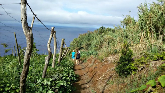
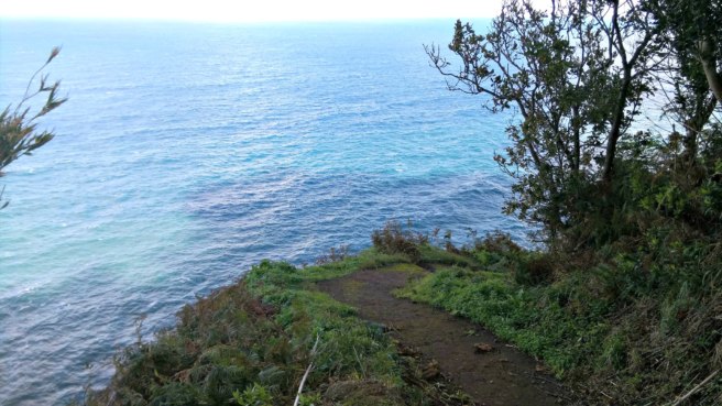
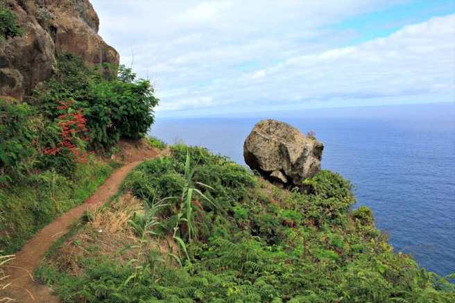
The next step is to find the path to the geocache. Once you are on the path, you will see why this geocache earned its 3.5 terrain rating. There are many paths—will you take the correct one? Will your path be full of mud with no alternate route? Will you slip and fall in the mud? Will this actually be worth it? Stay strong, intrepid geocachers, because yes, the payoff will be worth it.
Path to the geocache
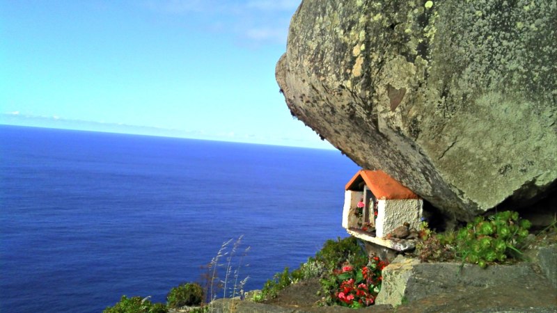
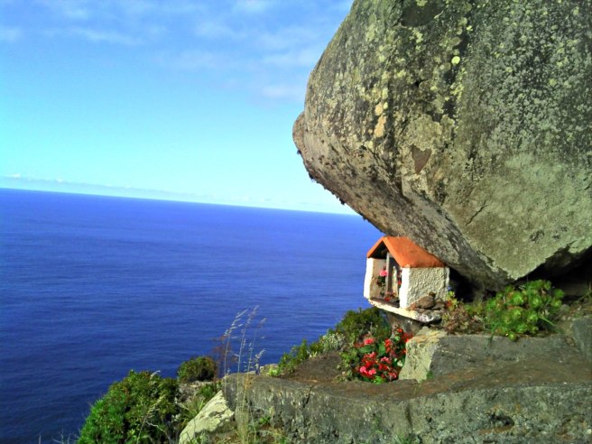
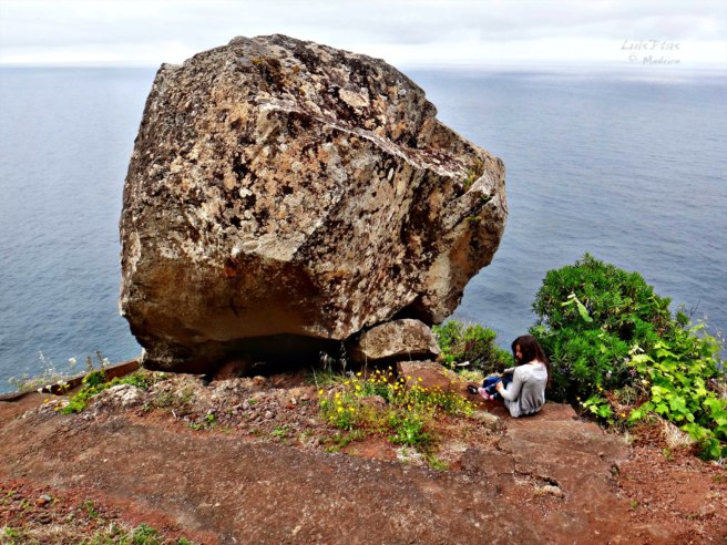
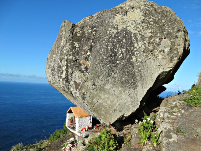
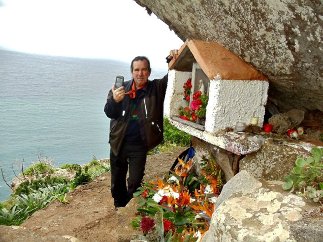
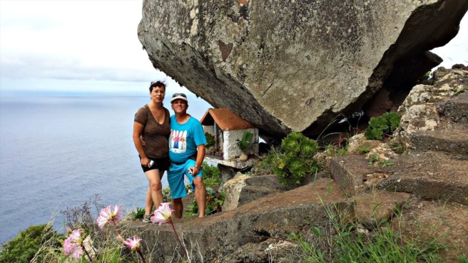
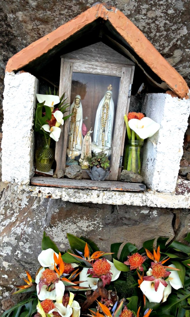
At the end of the path on the very edge of a cliff, you will find a very large rock. Many years ago it broke free from the hills above, rolled down the rugged terrain, then suddenly stopped right on this precipice. This was so amazing and odd that the locals built a small shrine in honor of the “Lady of the Stone” and placed it underneath the boulder. This “monument’ is full of religious statues, candles, flowers, stones, and other knickknacks. It is also a wonderful place for quiet reflection and to sign a logbook.
Path to the geocache
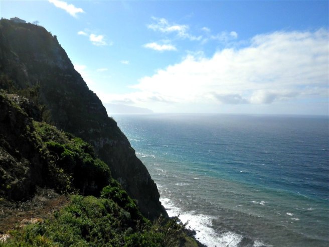
If this amazing rock and little shrine weren’t enough, check out that view! On the left you can see Porto Moniz very far away, while on the right you can look down and see the old pier of São Jorge. Can it get any better than this?
View from above the rock
Recent logs:
Siggi72This is my second time visiting Madeira but the first time with Geocaching. Without geocaching I wouldn’t have seen this “balancing” rock with the small shrine and the great views. Thanks for showing!
Amazing location for a geocache
ComètesOn our way, we could not miss this cache, that we already bookmarked in France when preparing our trip. Its D/T ratio is the only one missing in on matrix. We first discovered the lighthouse, then went down to GZ. 148 steps later, we were at the right place. A special place, as many ones that we can discover since we are practising geocaching. We found the box with the help of the spoiler. While we were signing the logbook, a rainbow appeared above the Ocean. To celebrate our fully filled matrix? Thank you for this great cache!
At the shrine under the rock
ED77First we had problems to find the right access and had almost given up. Fortunately we found the right way otherwise we have missed a great adventure and a total crazy place! The path down was a real adventure but at the end worth every step How curious to place a shrine under this huge stone! We enjoyed the mystic and peaceful place, stayed some time staring at the sea This place is worth a favorite point
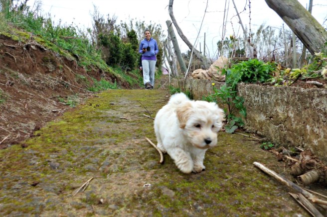
Just before the geocacheGreat view and a great experienceThe shrineGorgeous viewsView to the rightEven pooches love this geocache Source: https://www.geocaching.com/blog/2016/12/senhor-da-pedra-geocache-of-the-week/ (01/2017)
Com a rubrica "GeoFoto", o sítio GeoPT pretende lançar um passatempo interno entre os utilizadores do forum, que permita divulgar as suas fotos, bem como caches ou histórias por detrás desses momentos.
Aqui ficam as minhas participações com mais destaque:
O Patagarro é uma das 8 espécies de aves marinhas que nidifica no arquipélago da Madeira. Conhece mais pesquisando o Projecto Puffinus.
A cache está situada na Ribeira de Santa Luzia.
Não existe trilho. Deverás improvisar, tendo de atravessar várias vezes a ribeira.
Para lá chegar existem outras alternativas mas esta será a mais simples
Há a possibilidade de conjugar com outras caches da área: GC4FVVW, GC17K6C, GC17K5H e GC3T7QN.
O local possui fraco sinal GPS pelo que deverão utilizar os spoilers e dicas fornecidas.
A dificuldade desta cache depende do caudal da ribeira. Durante os meses de verão o acesso poderá ser mais simples mas a cascata poderá estar seca. Analisa as condições e não arrisques.
O percurso deverá ser feito apenas com boas condições climatéricas.
Deverás levar água e comida, roupa e calçado apropriados (roupa e calçado extra para o caso de te molhares).
A utilização de um bordão é recomendada.
Parking - Cache - Parking: 9 km, 4h
CACHE:
The Patagarro is one of the 8 species of seabird that nests in the Madeira archipelago. Know more by searching for the Project Puffinus.
The cache is located in Ribeira de Santa Luzia.
There is no trail. You have to improvise, having to cross the river several times.
To get there, there are other alternatives but this is probably the easiest.
It is possible to combine with other caches in the area: GC4FVVW, GC17K6C, GC17K5H and GC3T7QN.
The location has weak GPS signal and you should therefore use the spoilers and hints provided.
The difficulty of this cache depends on the flow of the stream. During the summer months access may be simpler but the waterfall may be dry. Analyze the conditions and don't take risks.
The course must be done only with good weather conditions.
You should bring water, food, clothing and appropriate footwear (extra clothing in case you get wet).