


SÃO JORGE

São Jorge pertence ao concelho de Santana, localizada no extremo norte da ilha, junto da Ponta de São Jorge. A freguesia é limitada, a norte, pelo oceano Atlântico e pela cordilheira do Pico Ruivo e tem uma área de 18, 3 km2. Crê-se que tenha hoje em dia cerca de 1.596 habitantes.
A criação da freguesia remonta ao ano de 1517. Reza a história que uma capela consagrada a São Jorge, depois convertida, no segundo quartel do século XVIII, em igreja paroquial, acabou por determinar o nome da freguesia. Na realidade, a freguesia de São Jorge teve o seu núcleo primitivo no sítio do Calhau, junto à foz da Ribeira, onde se instituiu uma capela no final do séc. XV. Uma capela que quase ficou destruída por um grande mau tempo em 1660.
Segundo escrevem alguns historiadores, durante mais de quatro séculos, São Jorge funcionou como um dos mais importantes entrepostos comerciais do norte da ilha da Madeira. Na realidade, numa pequena enseada marítima atracavam as embarcações vindas do Funchal e de outras paragens que abasteciam as freguesias de São Jorge e Santana. Mas, a partir do século XX, a construção da nova estrada, acaba com a preponderância da freguesia. A povoação entrou em declínio uma vez que deixou de ser ponto de passagem obrigatório.
St George belongs to the municipality of Santana, in the extreme north of the island near the Ponta de São Jorge and It has about 1,596 inhabitants. The parish is limited to the north by the Atlantic Ocean and by the mountains of Pico Ruivo and has an area of 18, 3 km2.
The creation of the parish dates back to 1517. The story goes that a chapel dedicated to St. George, then converted, in the secondquarter of the eighteenth century, in the parish church, eventually determined the name of the parish. In fact, the parish of St. George was born in what is now called Calhau, near the Ribeira de São Jorge, where a chapel was established at the end of the XV century. A chapel that was almost destroyed by severe weather in 1660.
Built in 1660 on the site of a small chapel of the fifteenth century, it was subsequently demolished to make way for the one we see today.
Qual a data que se encontra em cima da porta?
What is the date that is above the door?
N32º49.642
W16º54.411
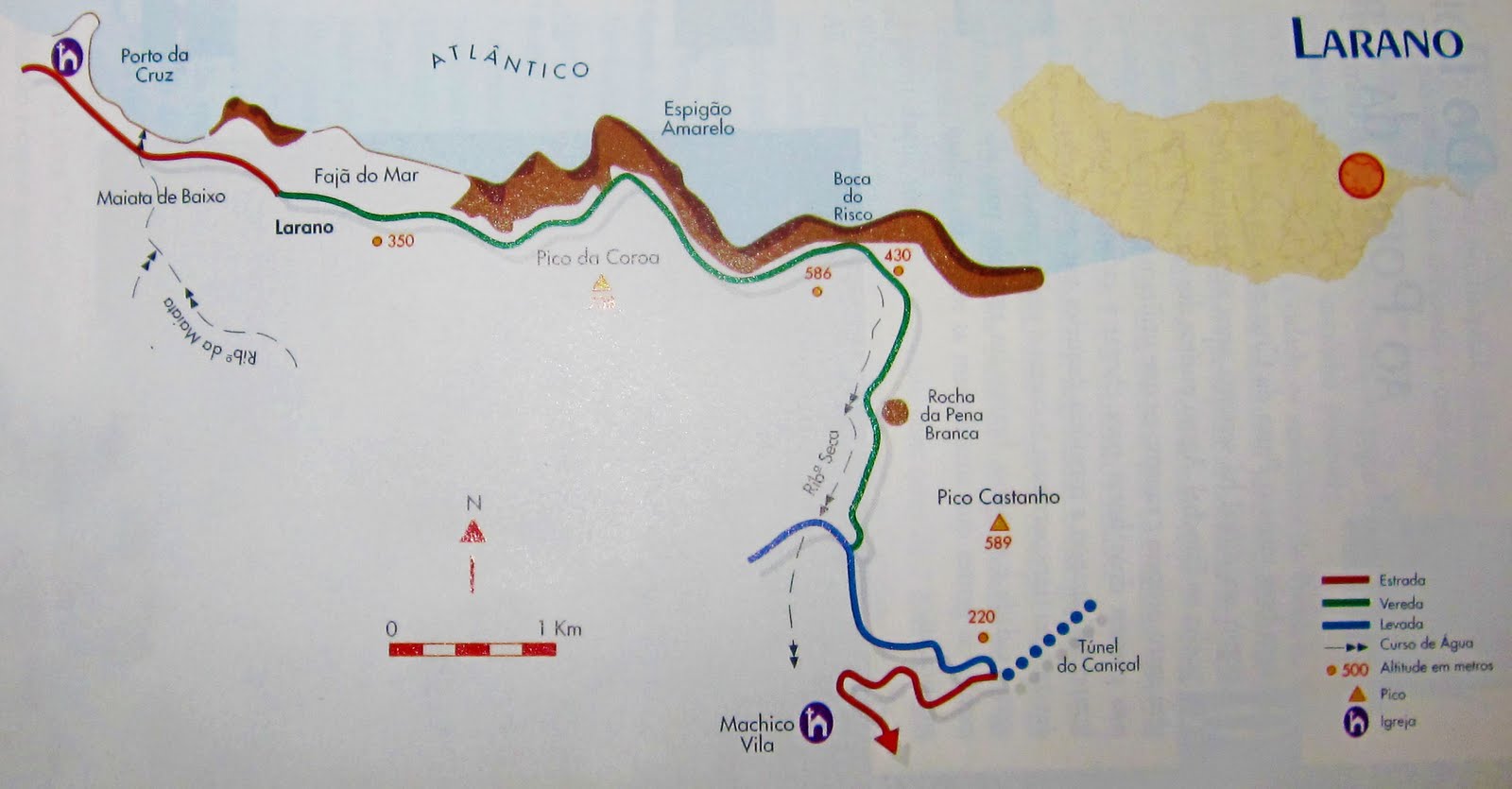
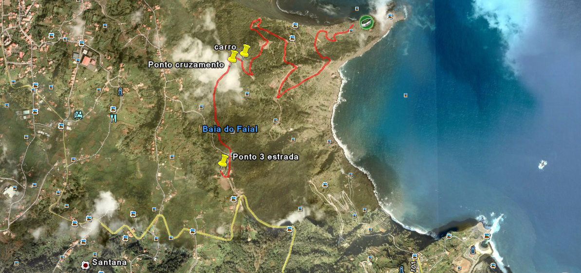
STAGE 4 - PARQUE DE MERENDAS

Um simples parque de merendas, com uma boa vista sobre o calhau de São Jorge onde nasceu a freguesia.
A simple picnic area with a good view of the Calhau, the birthplace of São Jorge.

Quantos fogareiros existem neste local?
How many brick stoves are on this site?
N32º49.833
W16º54.076
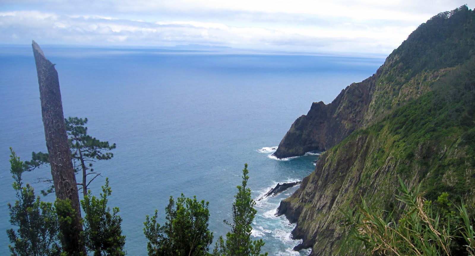
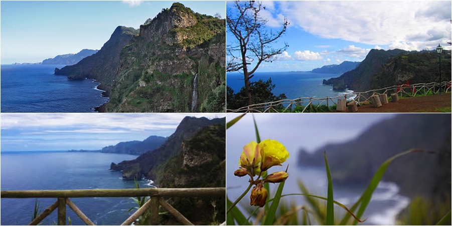
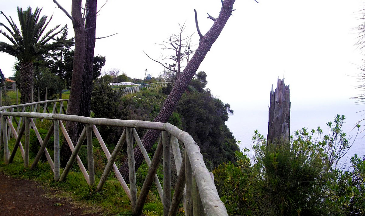
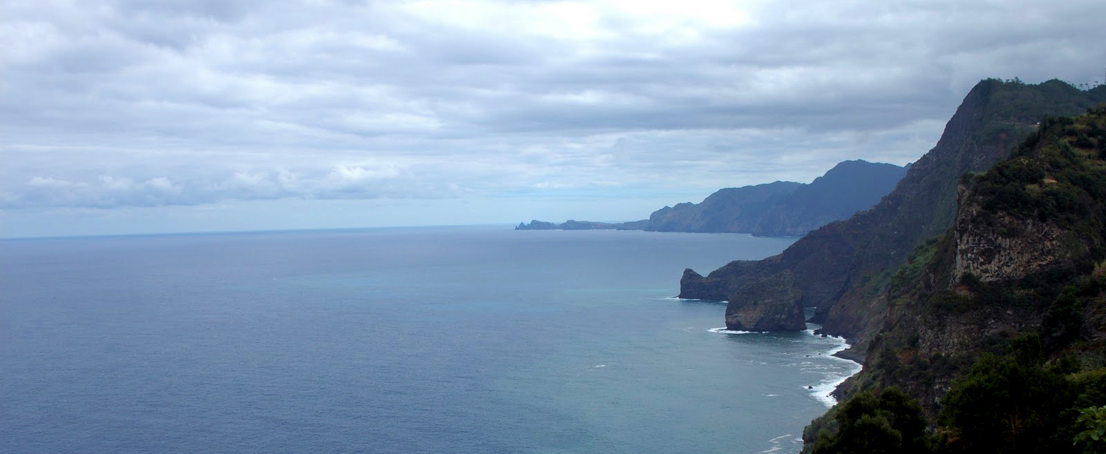
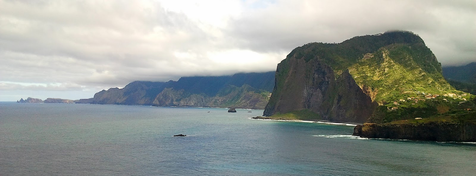
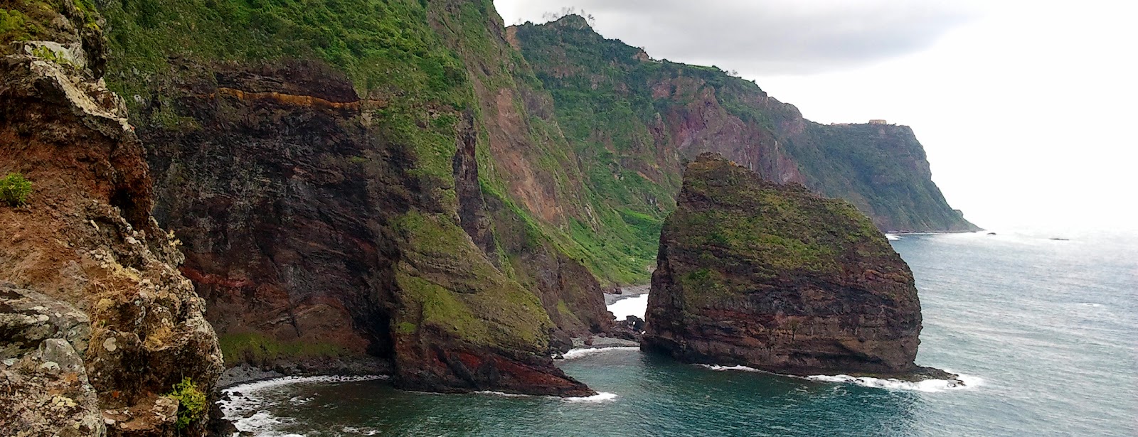
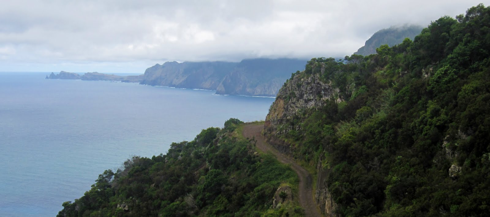
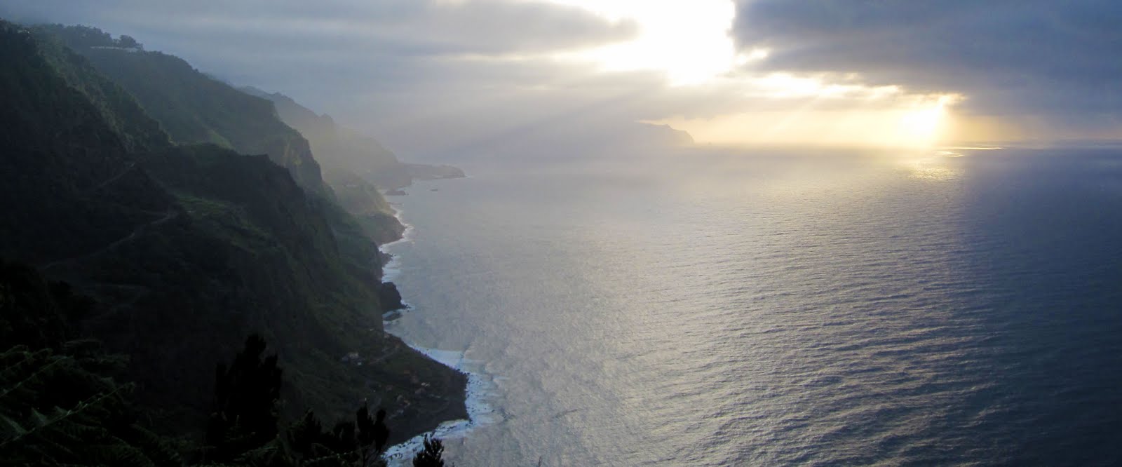
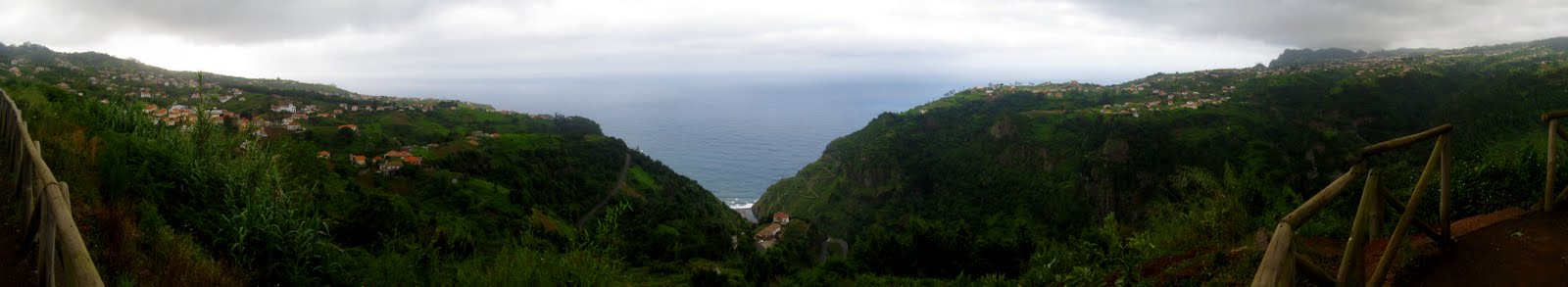
FINAL STAGE: VIGIA

Miradouro de onde podemos observar a costa norte de São Jorge ao Porto Moniz.
Viewpoint from where we can observe the north coast from São Jorge to Porto Moniz.
Final Coordinates:
N 32º 50.0AB
W16º 54.6CD
Answers:
(stage 1) + 3 = A
(stage 2) - 2 = B
(stage 3) - 1753 = C
(stage 4) = D

Boa Sorte! Good Luck!


São Jorge pertence ao concelho de Santana, localizada no extremo norte da ilha, junto da Ponta de São Jorge. A freguesia é limitada, a norte, pelo oceano Atlântico e pela cordilheira do Pico Ruivo e tem uma área de 18, 3 km2. Crê-se que tenha hoje em dia cerca de 1.596 habitantes.
A criação da freguesia remonta ao ano de 1517. Reza a história que uma capela consagrada a São Jorge, depois convertida, no segundo quartel do século XVIII, em igreja paroquial, acabou por determinar o nome da freguesia. Na realidade, a freguesia de São Jorge teve o seu núcleo primitivo no sítio do Calhau, junto à foz da Ribeira, onde se instituiu uma capela no final do séc. XV. Uma capela que quase ficou destruída por um grande mau tempo em 1660.
Segundo escrevem alguns historiadores, durante mais de quatro séculos, São Jorge funcionou como um dos mais importantes entrepostos comerciais do norte da ilha da Madeira. Na realidade, numa pequena enseada marítima atracavam as embarcações vindas do Funchal e de outras paragens que abasteciam as freguesias de São Jorge e Santana. Mas, a partir do século XX, a construção da nova estrada, acaba com a preponderância da freguesia. A povoação entrou em declínio uma vez que deixou de ser ponto de passagem obrigatório.
St George belongs to the municipality of Santana, in the extreme north of the island near the Ponta de São Jorge and It has about 1,596 inhabitants. The parish is limited to the north by the Atlantic Ocean and by the mountains of Pico Ruivo and has an area of 18, 3 km2.
The creation of the parish dates back to 1517. The story goes that a chapel dedicated to St. George, then converted, in the secondquarter of the eighteenth century, in the parish church, eventually determined the name of the parish. In fact, the parish of St. George was born in what is now called Calhau, near the Ribeira de São Jorge, where a chapel was established at the end of the XV century. A chapel that was almost destroyed by severe weather in 1660.
According to some historians, for more than four centuries, St. George served as one of the most important trading posts in the north of the island of Madeira. Indeed, in a small pier moored vessels coming from Funchal and from other locations who provided the parishes of St. George and Santana. But, in the twentieth century, the construction of new road, ends with the preponderance of the parish. The population has declined since then.
CACHE:
Esta cache leva-nos a 5 lugares a não perder neste lindo local. Deverá procurar a resposta às questões e realizar as simples contas no final.
This cache brings us to 5 places that you should visit in this beautiful location. Look for the answers at the given coordinates and perform simple accounts at the end.
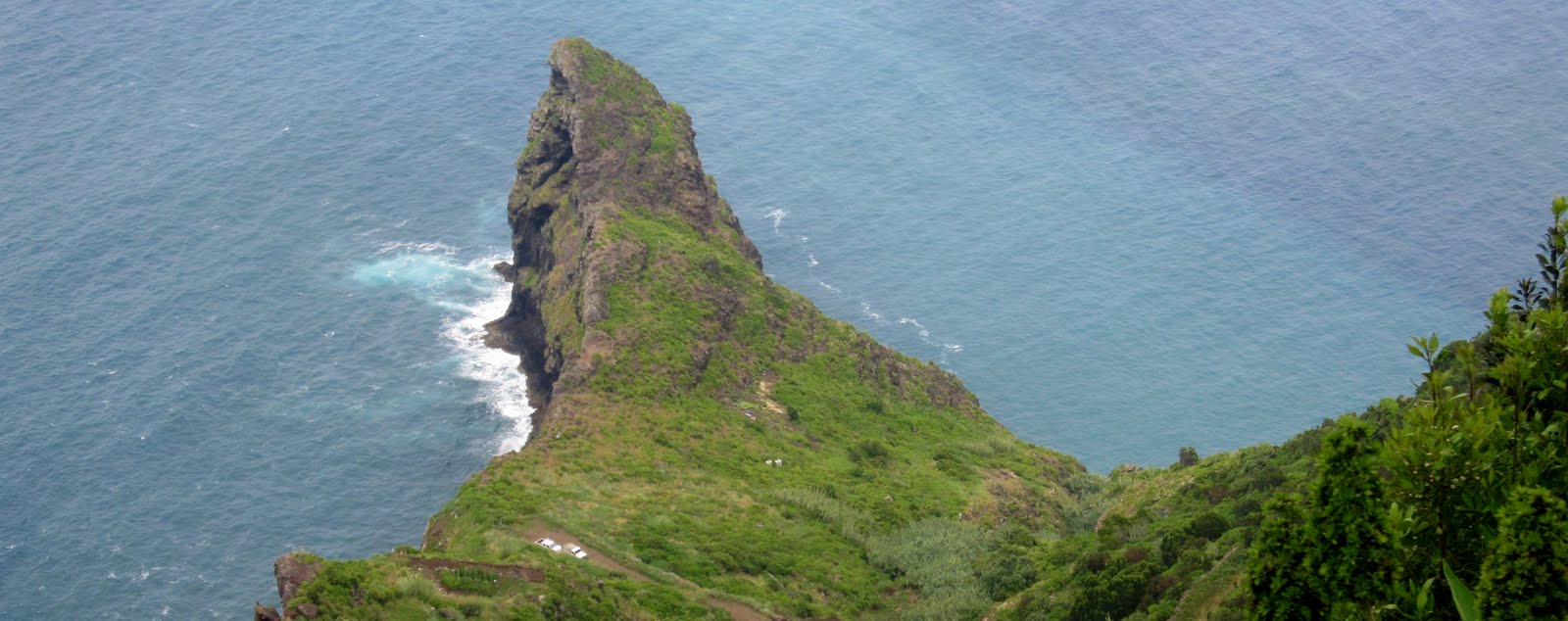
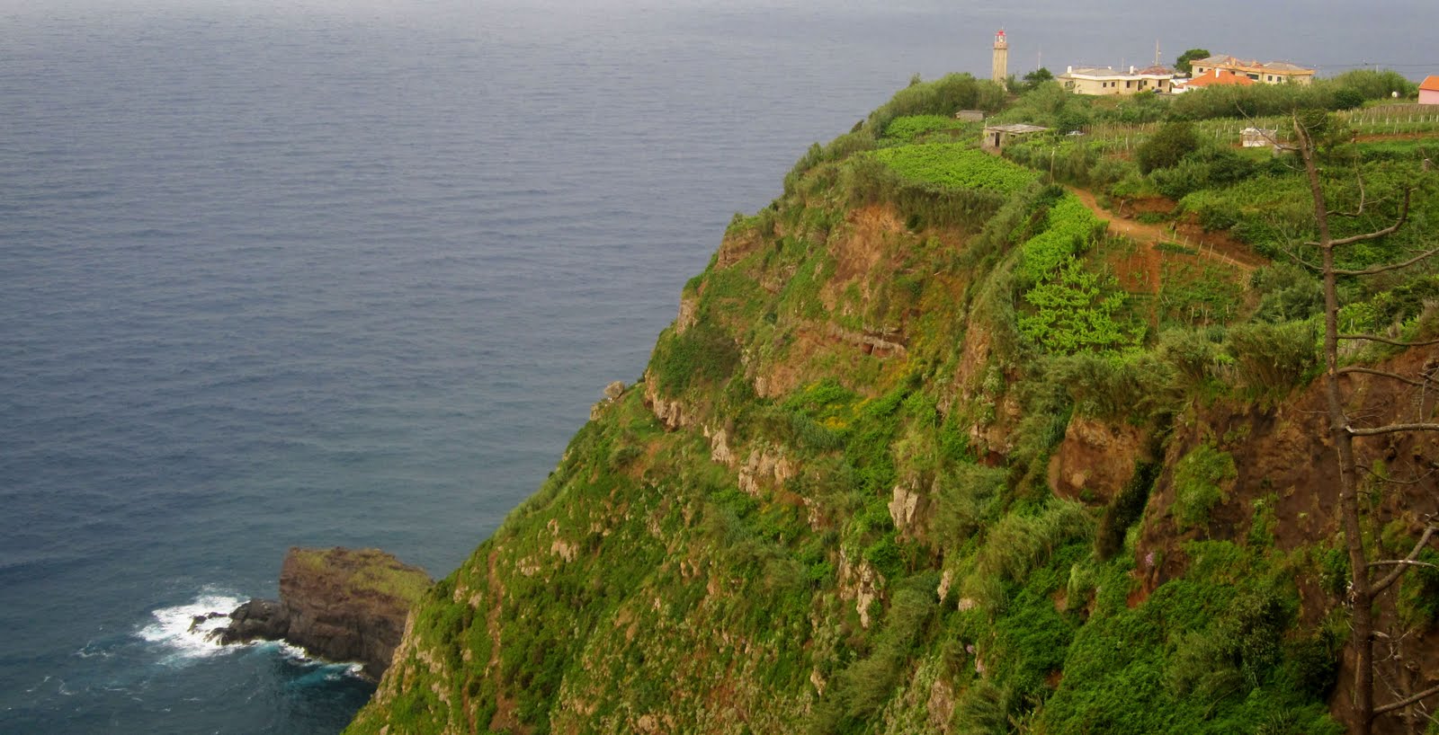
STAGE 1 - MIRADOURO DO LOMBO DO PICO / LOMBO DO PICO VIEWPOINT

O Miradouro do Lombo do Pico em Santana fica localizado no enfiamento da foz da Ribeira de São Jorge, sendo possível se avistar parte da zona balnear que lá existe. Este miradouro oferece uma vista completa sobre as montanhas circundantes à freguesia da Ilha e de São Jorge.
The Lombo do Pico viewpoint in Santana is located next to the mouth of the Ribeira de SãoJorge, being possible to see part of the beach area that is there. This viewpoint offers a full view of the mountains surrounding São Jorge and Ilha.
Quantas mesas existem nestas coordenadas?
How many tables there are at these coordinates?
N32º49.355
W16º54.141
STAGE 2 - MOINHO DE ÁGUA / WATER MILL

Em São Jorge, ainda está actividade o último moinho de água da Madeira. O Moinho de Água de São Jorge conta já com cerca de 300 anos de história, tendo sido recuperado em 2000 e desde aí tem tido grande procura para moer o milho e o trigo. Este moinho é um bom exemplo de preservação; alimentado com as águas da Levada do Rei, faz moer o trigo, o milho, a cevada e o centeio plantados em poios agrícolas de São Jorge.

In São Jorge, it is still active the last water mill in Madeira. The Water Mill of São Jorge now has nearly 300 years of history, having been recovered in 2000 and since then has had high demand for grinding corn and wheat. This mill is a good example of preservation; it is fed by the waters of the Levada do Rei, it grinds wheat, corn, barley and rye grown on the agricultural fields of São Jorge.

Quantas janelas tem o moinho?
How many windows has the mill?
N32º49.201
W16º54.897
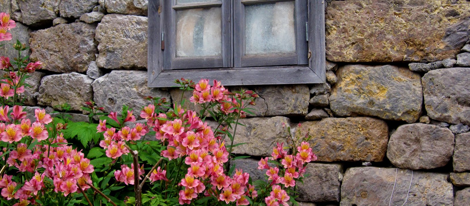
STAGE 3 - IGREJA MATRIZ DE SÃO JORGE

Edificada em 1660, no local onde existia uma pequena capela do século XV, foi posteriormente demolida para dar lugar à actual.
CACHE:
Esta cache leva-nos a 5 lugares a não perder neste lindo local. Deverá procurar a resposta às questões e realizar as simples contas no final.
This cache brings us to 5 places that you should visit in this beautiful location. Look for the answers at the given coordinates and perform simple accounts at the end.
STAGE 1 - MIRADOURO DO LOMBO DO PICO / LOMBO DO PICO VIEWPOINT
O Miradouro do Lombo do Pico em Santana fica localizado no enfiamento da foz da Ribeira de São Jorge, sendo possível se avistar parte da zona balnear que lá existe. Este miradouro oferece uma vista completa sobre as montanhas circundantes à freguesia da Ilha e de São Jorge.
The Lombo do Pico viewpoint in Santana is located next to the mouth of the Ribeira de SãoJorge, being possible to see part of the beach area that is there. This viewpoint offers a full view of the mountains surrounding São Jorge and Ilha.
Quantas mesas existem nestas coordenadas?
How many tables there are at these coordinates?
N32º49.355
W16º54.141
STAGE 2 - MOINHO DE ÁGUA / WATER MILL
Em São Jorge, ainda está actividade o último moinho de água da Madeira. O Moinho de Água de São Jorge conta já com cerca de 300 anos de história, tendo sido recuperado em 2000 e desde aí tem tido grande procura para moer o milho e o trigo. Este moinho é um bom exemplo de preservação; alimentado com as águas da Levada do Rei, faz moer o trigo, o milho, a cevada e o centeio plantados em poios agrícolas de São Jorge.
In São Jorge, it is still active the last water mill in Madeira. The Water Mill of São Jorge now has nearly 300 years of history, having been recovered in 2000 and since then has had high demand for grinding corn and wheat. This mill is a good example of preservation; it is fed by the waters of the Levada do Rei, it grinds wheat, corn, barley and rye grown on the agricultural fields of São Jorge.

Quantas janelas tem o moinho?
How many windows has the mill?
N32º49.201
W16º54.897
STAGE 3 - IGREJA MATRIZ DE SÃO JORGE

Edificada em 1660, no local onde existia uma pequena capela do século XV, foi posteriormente demolida para dar lugar à actual.
Built in 1660 on the site of a small chapel of the fifteenth century, it was subsequently demolished to make way for the one we see today.
Qual a data que se encontra em cima da porta?
What is the date that is above the door?
N32º49.642
W16º54.411
STAGE 4 - PARQUE DE MERENDAS

Um simples parque de merendas, com uma boa vista sobre o calhau de São Jorge onde nasceu a freguesia.
A simple picnic area with a good view of the Calhau, the birthplace of São Jorge.
Quantos fogareiros existem neste local?
How many brick stoves are on this site?
N32º49.833
W16º54.076
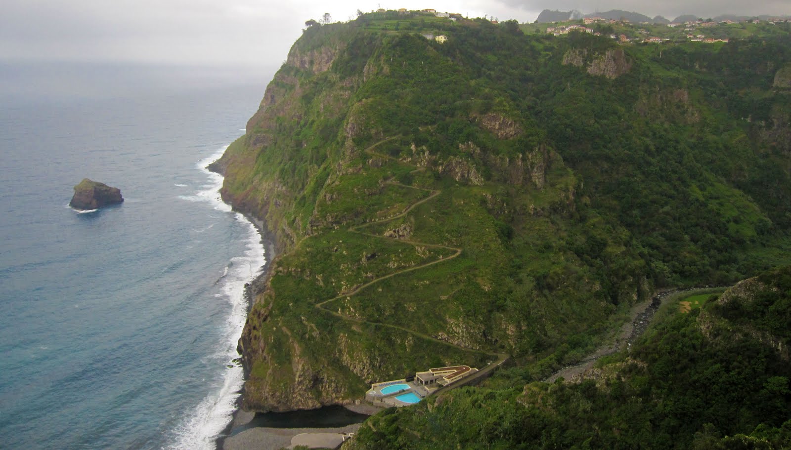
FINAL STAGE: VIGIA
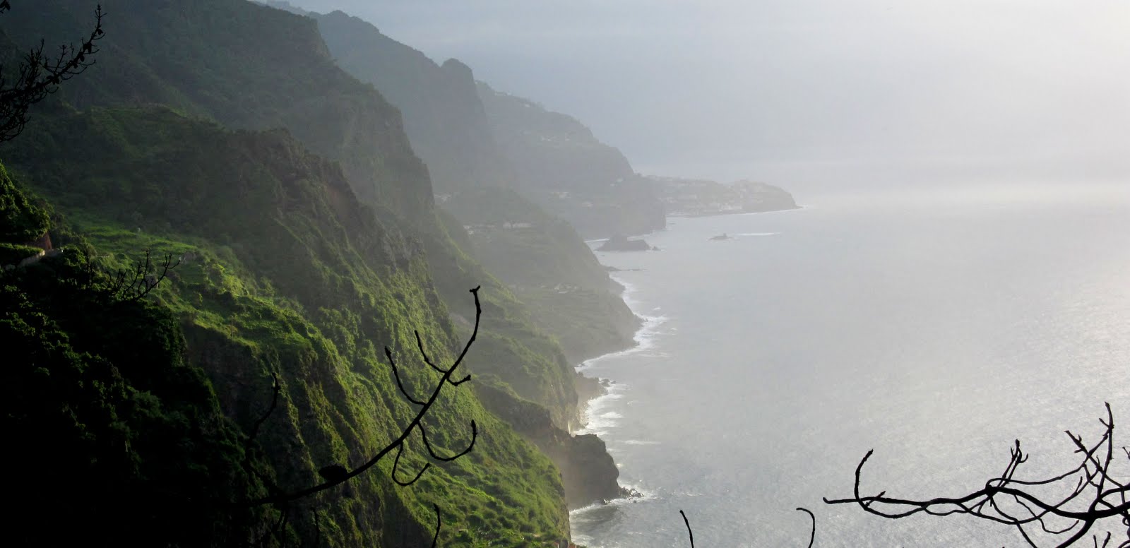
Miradouro de onde podemos observar a costa norte de São Jorge ao Porto Moniz.
Viewpoint from where we can observe the north coast from São Jorge to Porto Moniz.
Final Coordinates:
N 32º 50.0AB
W16º 54.6CD
Answers:
(stage 1) + 3 = A
(stage 2) - 2 = B
(stage 3) - 1753 = C
(stage 4) = D
Boa Sorte! Good Luck!